
Our Editors independently research, test, and rate what we feel are the best products. We use affiliate links and may receive a small commission on purchases.
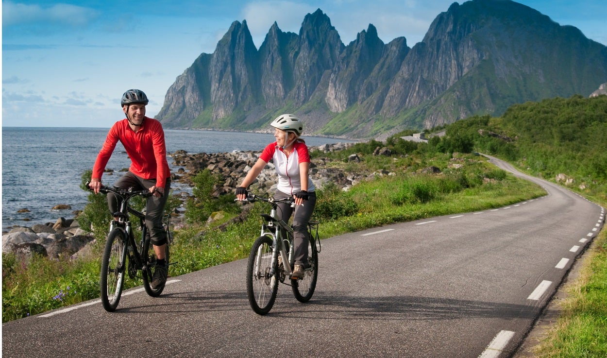
There’s a place we all want to go when we climb into the saddle of a bicycle.
For some people, it has a name; it is the “there yet” destination that children whine about when hunger, impatience, and nature call. It is the slam of the inside door and whir of the A/C fans and satisfaction of knowing that the hot bath and unplugged phone await.
However, for many others, it is the semi-transcendence of just being on the way to wherever “there yet” is; it is the rush of merely being in the saddle, legs spinning, heart pumping and wind catching the grooves and corrugations of a snug Rock-locked helmet.
The bath can wait, as can the hug of privacy. There is satisfaction in the groove of consistent motion that makes the trip to point B just as (if not more) exciting than actually B-ing there.
But even for enthusiasts of the latter variety, every way does not lead to the Way (to borrow from a Buddhist axiom).
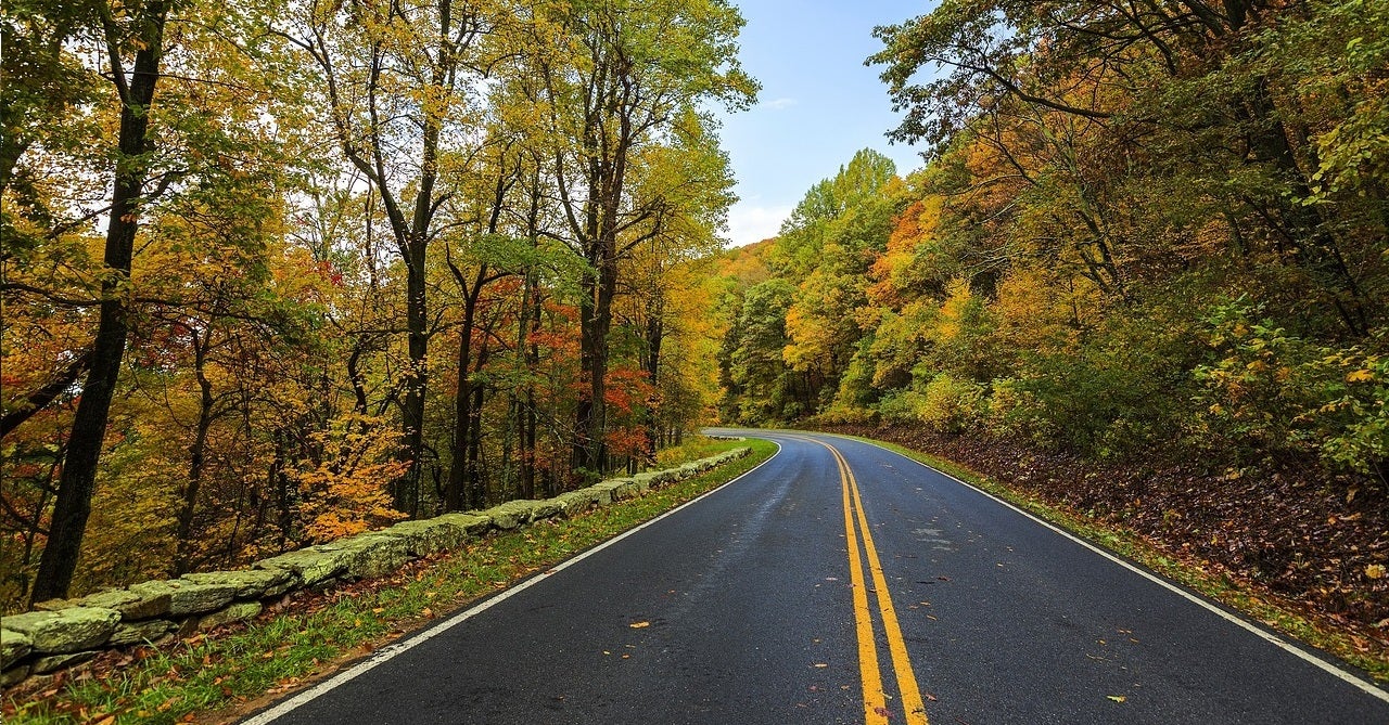
The way along a shoulder on a commercial vehicle access road is a far cry from the way along a scenic and remote county path through the Fall-yellow thick of an aspen grove and the scarlet symphony of a maple swarm.
The way through the crush of an urban jungle does not allow for the same introspection that the way along a mountain ridge road of breathless horizons does.
Where then are these true and special ways to the Way? Which inspiration do you follow when that three-day weekend screams to be filled with something more gentle than the local block party or the tailgate or the carnival atmosphere of the nearest patch of picnic green?
Everyone has a few neighborhood favorites. You know, the behind-the-shed, cross-the-bog, back-alley traverse that leads to a mellow stretch of road with a vista. Some are more dramatic than others, and are good for that odd afternoon escape.
But where are the slightly longer, bigger bites when one day’s chewing isn’t enough? Where’s the really tall playground slide that truly challenges a kid’s sense of adventure and fear of heights, and then rewards with that greater rip through the air and echoing giggle when spit out at the bottom into a tumble of sand and appreciating friends?
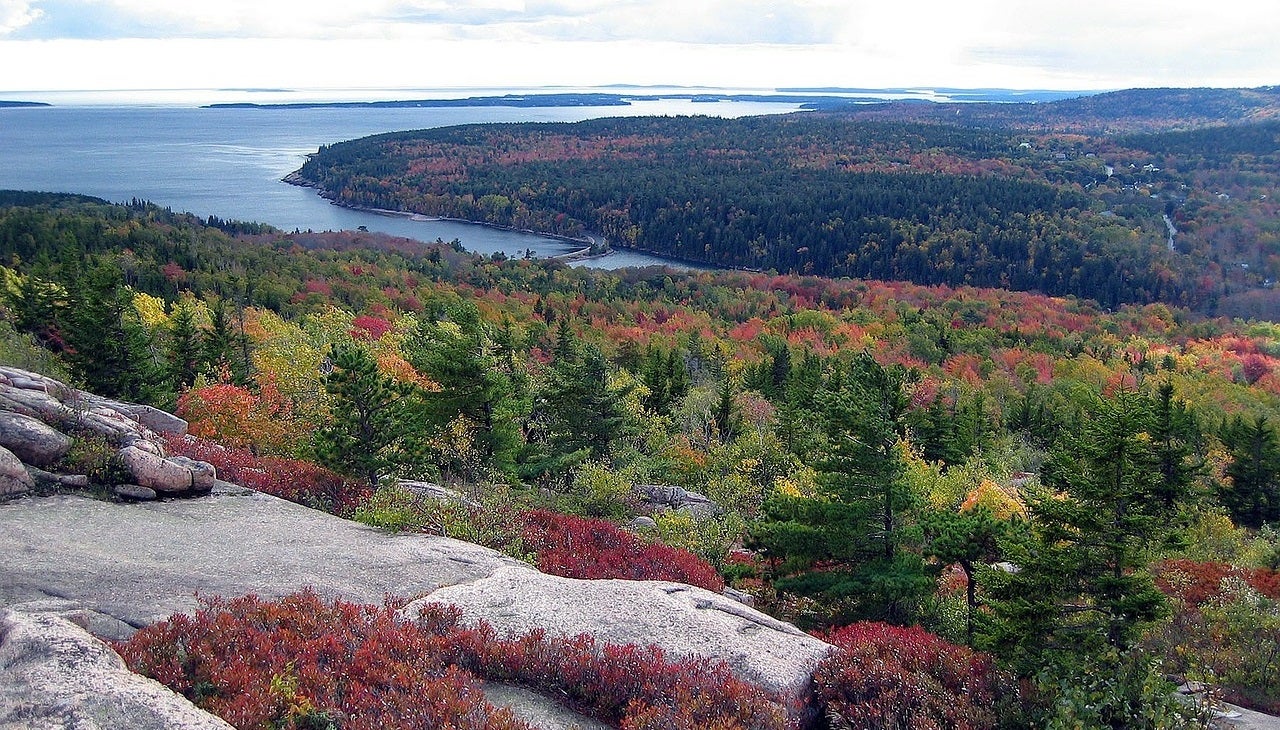
Mount Desert Island and Acadia National Park, Maine
 There is a soft luster and mossy pace to Maine. The earth’s natural redolence finds slow and sweet expression in its long and fertile stretches of field and forest.
The people, many of whom tend to the land in a fashion as flexible and firm as a willow, know what they know and know that they need to know no more. Even the animals, domesticated and wild, have woven themselves calmly and authoritatively into the fabric of the Vacationland state.
Acadia National Park, located on Mount Desert Island about two-thirds of the way up the coast, draws more visitors per acre than any other national park in the United States. This may make it sound crowded, but it isn’t. And it is a joy. An elemental country where land and sea have collided to bring about the best of natural splendor, Acadia is as much the dry heights of Cadillac Mountain as it is the goo of the sea-fed tidal basins.
Cycling in Acadia is worth every bump you take, and with more than 120 total miles of hiking trails in the park, including 43 miles of bikable carriage roads—car-free woodland roads—you have an opportunity not to suffer the burnt fossil fuel fumes and aggravation of the car-bound.
That said, the 20-mile Park Loop Road, a two-lane one-way car avenue of slow-moving traffic, provides an unparalleled dramatic ride (especially if you make the seven-mile added puff up to the top of Cadillac Mountain).
Come for an extended weekend, mix, and match the trails. You will never tire of the terrain, the tug of the air, or the tweeting of nature, just be sure to have a comfortable bike saddle!
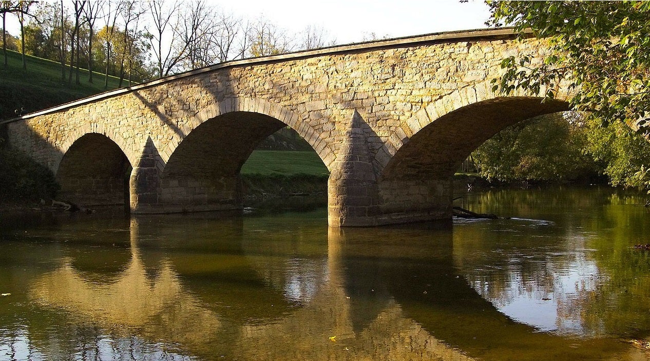
Three Bridges, New Jersey
 Despite Bruce Springsteen’s best efforts, New Jersey is still the punchline of a fair share of jokes. Most of this is due to the unsightliness of the Meadowlands, an eastern lowland industrial strip crisscrossed by C02-clogged highways.
Fortunately, even the most staid comedians have also learned to look further west to the true warmth of the state. Many people forget that the Appalachian Trail dips into New Jersey up where the Delaware Water Gap National Recreation Area spans the border with Pennsylvania.
This is sometimes a surprise to first-timers in the area. . .and brings them back again and again. Keep in mind that New Jersey is, after all, the Garden State.
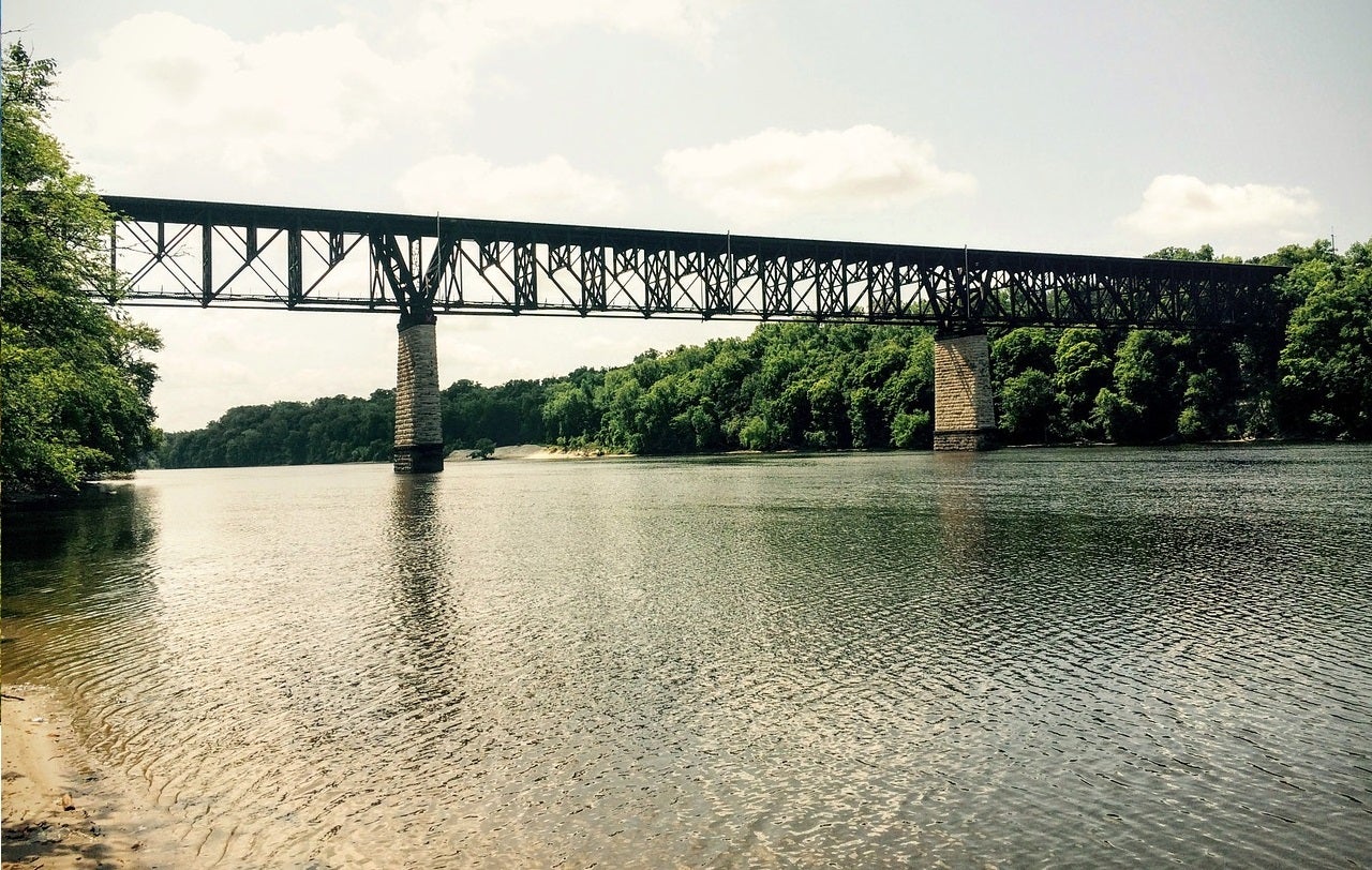
Central-western New Jersey is lovely, and one of the prettiest areas there is Hunterdon County, where the age-old Appalachians ripple by. The Delaware River here is the border between New Jersey and Pennsylvania; we suggest an enjoyable trek that could send you over as many as three of the area’s bridges.
The rest of the time, you are in for a semi-strenuous ride with fine panoramic vistas of well-kept farms and woods and attractive clapboard houses.
Two good places to start from are Flemington and Clinton. They represent the northwestern and northeastern corners of a roughly square area of quiet and pleasurable back roads. Check out the Hunterdon Historical Museum Village for a good introduction to the area, then revel in ups and downs that will keep you busy all the way to the Delaware River’s edge.
The bridges at Frenchtown, Milford, and Riegelsville give you access to similarly bike-friendly roads in Pennsylvania. At Riegelsville, there’s the Volendam Windmill and Museum for those who are intrigued by milling practices of the past. If you have extra time, head through and past Phillipsburg and up the New Jersey side of the river as far as Belvidere.
Sugarloaf, Maryland
One problem with living in big cities is the distance you sometimes have to travel to get to good green countryside and fine rides along gentle county roads. For cities caught in the riptide development of the east coast megalopolis sweep, this distance is getting greater and greater. Fortunately, this is not necessarily the case for those trapped in the loose nets of the Washington, D.C., beltway.
If you have the time, a great place to start is right in Georgetown on a path running for 184.5 miles along the Chesapeake and Ohio Canal and through the C and O Canal National Historic Park. For those with less time, Poolsville is a favorite starting point for many area riders and is less than an hour’s drive from the Capitolâ an easy scoot up the Potomac. (This is about 35 miles up the canal across from Leesburg, Virginia.)
You could of course stay along the canal for as long as your time and legs hold out. There is plenty here for any weekend overnighter. However, you might also consider slipping inland and trying your thighs on something a little tougher: a “mountain.” Sugarloaf rises dramatically from the rather flat Monacay Valley to 1,280 feet. The tallest thing around, it was used as a watchtower and signal station by Union troops monitoring Lee’s progress toward Antietam.
After playing along whatever length of the C AND O you desire, or first setting wheel to pavement in Poolesville, head north. The whole area is a maze of quiet country roads flanked by century-old, stone, property-line walls and hundred-year-old homes.
Concerned about traffic?
Don’t worry. During the weekend, you may actually see more cyclists than you will cars. Imagine a world like that! Sugarloaf Mountain is just on the Frederick side of the county line and can be accessed from the town of Stronghold. FDR once coveted this land so much that he petitioned its owner to have it turned into a summer White House. The owner declined and suggested another spot further north, known today as Camp David.
A full exploration of this area is the makings for a very pleasant weekend. For more about rides in the area, check out the resources of the Potomac Pedalers Touring Club, Inc. and program them into your bike computer GPS or smart phone and set off.
Skyline Drive, Virginia
The Appalachian Mountains of Virginia have been attracting oglers and peepers for many many years. And for good reasons: The spring and summer sylvan grace of the surrounding Blue Ridge Mountains, the prismatic brilliance of the autumnal leaf spread, and the cutting chill of the ocean-bound winds pulling at the hair of stubborn all-weather Appalachian thru-hikers are incomparable.
In the heart of these mountains, Shenandoah National Park is a long, narrow playground of wildlife and flowers. Looking out across the hills, it is almost possible to imagine this country as the wild and wonderful land it once was. For that reason alone, it is amazing.
Skyline Drive runs for 105 miles along the length of Shenandoah National Park. The northern continuation of the Blue Ridge Parkway, it sticks to the high points of a rampart of mountains and has views west out to Shenandoah Valley and east to Virginia proper and the Atlantic.
For many cycle tourists, the Skyline is the ultimate experience. Its length, its majesty, and its relentlessness (humbling even to the most swarthy) make it a mecca for those seeking a vacation that isn’t just about sightseeing in jaw-slacked awe and developing a good poolside manner.
One of the most popular starting points is at the northern end of the drive at Front Royal, Virginia. As you might have guessed, since the Skyline is a ridgecrest road, there is some climbing to be done right at the outset. Actually, it is a total of 22 miles of climbing up 2,000 feet to 3,385-foot Hogback Overlook.
You won’t face anything like that again, but don’t think that the rest of the ride will be easy. There is no paved shoulder on the Drive, but that’s OK; the road is usually wide enough for comfortable sharing. Watch out for RVs anyway and keep a bicycle light turn on for visibility.
Driftless Area, Wisconsin
Wisconsin got its nickname, the Badger State, not from the animal, but from the badger-like dens burrowed into the hillsides of its southwestern region by early 19th-century miners (known as “badgers”) protecting their lead ore claims. That and a general sensitivity to the land (and of course the well-deserved reputation for cheese) are part of this state’s heritage.
Today, perhaps as a function of that, there is also a commendable awareness of the bicycle as a viable alternative means of transportation. An increasing number of state byways have been declared “Rustic Roads,” indicating they pass over rugged terrain and through native vegetation and wildlife. Speed limits are restricted on these roads, making them perfect for the pedaler. If only this kind of civic-minded behavior would be copied elsewhere. . .
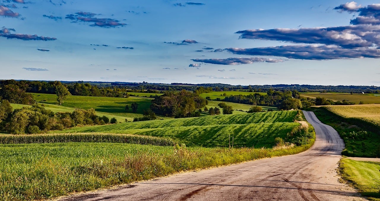
Southwestern Wisconsin is known to some as the Driftless Area. Unlike the rest of the state, it is characterized by steep hills and narrow valleys. In fact, it would make a New Englander feel right at home. The contrast is due to the wanderings of errant ice during the glacial ages, when the other two-thirds of the state was planed and scraped into more level submission.
The land bergs never quite made it to the southwest. As a result, the more spectacular and gentle-handled effects of water and wind erosion are there for you to enjoy.
Some of the nicest cycling is in the area south of the Wisconsin River and west of Wisconsin Route 23. Consider two areas of indulgence. North of Route 18, you can tour Frank Lloyd Wright country; south of the same, you can visit some of the miner realms that helped give Wisconsin its character.
The Spring Green Valley was the home of Mr. Wright, architectural genius who gave America some of its most distinctive and naturally inspired buildings. Works by this brilliant mind and his apprentices are easy to spot, and some of the more outstanding examples, like Taliesin and the House on the Rock, are tourist attractions in their own right.
Farther to the south, Route 151 between Dodgeville and Platteville offers a different, industry-oriented look at this state’s history. The Mining Museum in Platteville is a good place to start.
Natchez Trace Parkway, Mississippi
The American South was once home to great tribes of native people whose need to move through the wilds—in search of food, water, peace and solitude, friendship—was hindered most by the environment in which they lived. A full canopy of trees hung over great portions of this land and navigation meant sluicing through thick underbrush.
Despite the challenges, over the years, these people – the Natchez, Chickasaw, and Choctaw Indians—strung together hunting paths until there was a true trail from Mississippi all the way to Tennessee. First the 18th-century French found it, then the itinerant Ohio River Valley farmer merchants.
As traffic increased, so did the ease of travel along the trail, virtually a road by 1810. Since 1930, the National Park Service has been constructing a paved thruway that stays faithful to the course of the original trail. Nearly complete, there is now an unhurried 442-mile strip between Natchez, Mississippi, and Nashville, Tennessee.
Cycling along the Natchez Trace Parkway is a treat. Peppered with bicycle-only campgrounds, convenient places for service and maintenance stops, and clear directions available for bypasses in some of the more congested areas (like Jackson, Mississippi), this is a byway with everything that cyclists of all skill levels could want.
Heading south, pick up the Parkway off Tennessee Route 100 before Linton and Fairview, then just follow signs. For good information about cycling along the Parkway and for a Parkway map, write to U.S. Department of Interior, National Park Service, Natchez Trace Parkway, 2680 Natchez Trace Parkway, Tupelo, MS 38801.
Cajun Country, Louisiana
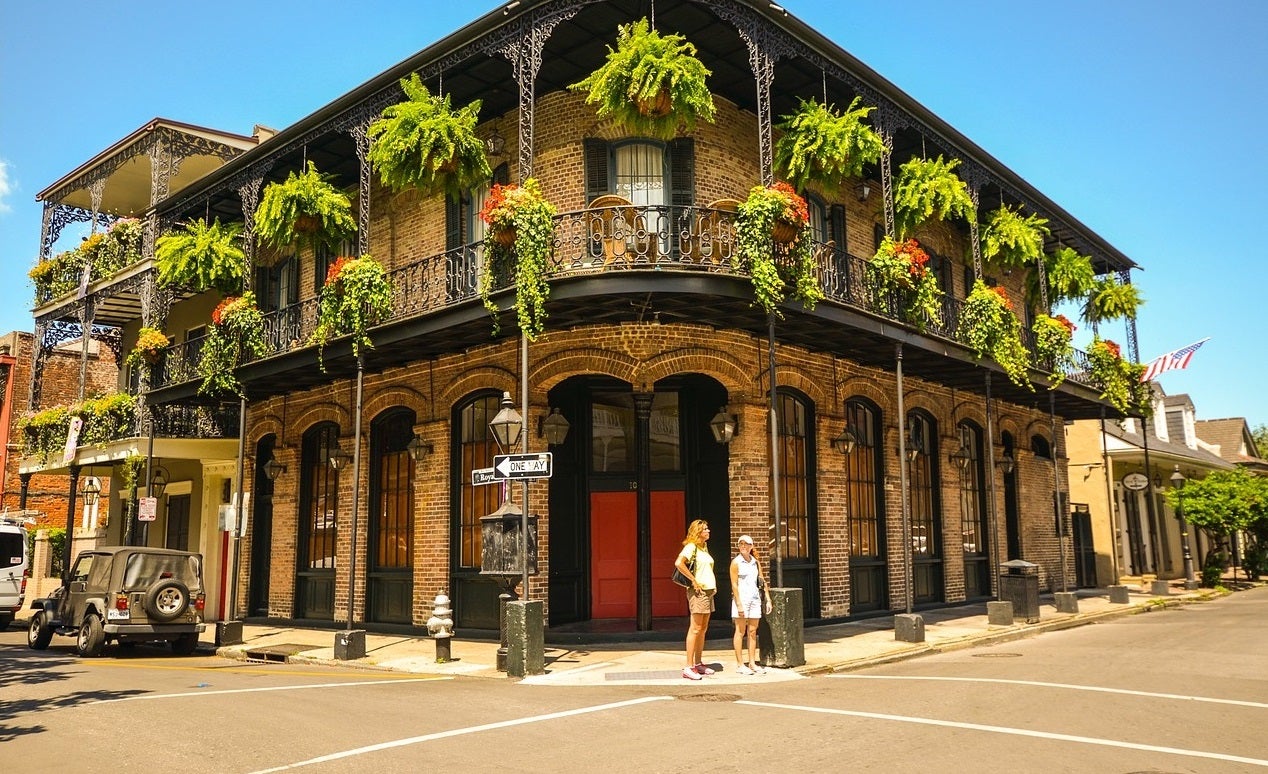
What comes to mind when you think of Louisiana? Gumbo. Jazz. Mardi Gras. Crocodiles. Bayou. Sure enough, this is all there . . . and in surfeit. But none of this suggests the possibility of quality scenery or alluring roads along which a good cycle can be had.
However, there are parts of Louisiana that rival the best in non-Rockies road riding anywhere in the United States. And where else in America are you going to be able to round out a full day of pedaling with unsurpassed jambalaya?
Cajun country is nearly the full length of the Louisiana Gulf Coast (minus the Mississippi Delta) from Sabine National Wildlife Refuge all the way to Grand Isle State Park. It is the swampy bayous, saltwater marshes, and Cajun and Creole cultures that have attracted the curious for decades. Replete with natural resources, the countryside will provide fodder to every one of your senses.
And taking it all in from the saddle of a bike is a far, far better way than others. One area in particular, east of Lafayette and south of Interstate 10, is a grand expanse of untillable and sparsely inhabited land. Most of this is the breathtaking Achafalaya Basin, one of the great natural wonders of North America. Any ride around here and through the communities flanking it will be one you never forget.
One excellent approach to seeing this area is to tack together rides along two of Louisiana’s scenic byways: the Promised Land and the Bayou Teche. A turn along the Promised Land could begin in St. Martinsville (on Route 31) and take in Longfellow-Evangeline State Historic Site, a Creole cottage/plantation home and estate that introduces the French-speaking cultures of the area.
At New Iberia, the Bayou Teche Scenic Byway begins. First sweeping south on Route 83 and then northward through Baldwin to Lake Fausse Pointe State Park, you will get a real taste of the south. Lake Fausse Pointe is the jump-off point for visits of the Achafalaya Basin. A good place to finish your ride is in Morgan City.
If you tell anyone that you are going to Colorado, the assumption is that you are headed straight for the mountains. Usually, this is not incorrect. With the Continental Divide loping nonchalantly across the state following range after range of 10,000+-foot peaks, there is little chance that the eastern plains are what’s drawing you in.
Well, why should you be different from anyone else? Besides, for the gluttonous among us, Colorado offers opportunities to tackle climbs not often found elsewhere in the United States.
The Peak to Peak Highway in the Arapaho National Forest runs for 55 miles from just outside of Boulder to Estes Park, the gateway to Rocky Mountain National Park. With panoramic views out to mountains and dramatic fall foliage colors, this highway glides through nature as well as historic former mining communities with preserved period architecture.
The road’s average elevation is greater than 9,000 feet and will give the unacclimatized a taste of the challenge faced by hasty covered-wagon pioneers skeedaddling west before the snows caught them mid-mountain.
The town of Ward is pretty much the high point of the route, with Nederland to the south and Estes Park to the north the “low” points. Thus it doesn’t really matter how you tackle the ride: You are in for hills regardless.
From Boulder, give a thought to following the farmland side roads (not busy Route 36, although it does have a wide shoulder) as far as Lyons and then heading west over to Estes Park (some tough hills). (If you have plenty of time, you might consider a round trip from Estes Park on the Trail Ridge Road—the highest through-highway in United States—through Rocky Mountain National Park. Caution: Do NOT try this until you know what you are getting into!).
From Estes Park turn south on Route 7 and begin the climb up to what makes the Peak to Peak what it is. If you want to cut your trip short, head back to Boulder via Lyons on Route 7 or drop down to Pleasant Valley and then climb up to Ward (a long 10+-mile hill).
Onward to Nederland and then out of the hills back to Boulder. Remember that cycling on 6W is not allowed, so if you go as far as the end of the Peak to Peak (at Black Hawk), make sure you have a ride home.
There are plenty of ways to extend the scope of this route or to shorten it, or even to ignore it completely and try other scenic routes in the area. Make sure you get a good map and study the options. Knowing the elevations will help!
Kanab and Kaibab Plateaus, Arizona
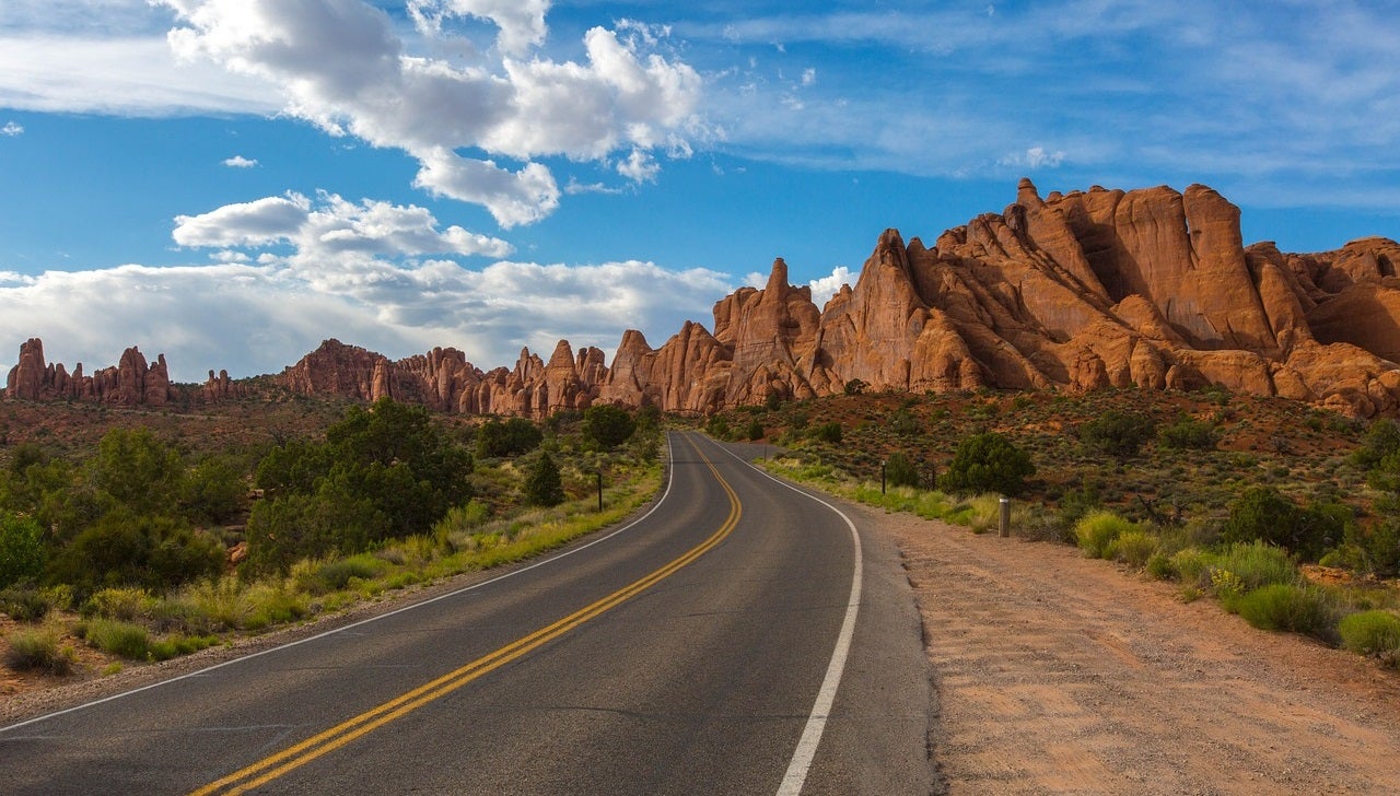
Utah and Arizona may not have the Rockies reaching down their spines but they are no less blessed with glorious and unique bits of earth. Southwestern Utah and northwestern Arizona in particular are awash in stunning protected natural wonder.
With Zion, Bryce Canyon, and Grand Canyon National Parks, Kaibab National Forest, and Grand Staircase-Escalante National Monument, everywhere you look there are sites unlike anything you have ever seen before. What better place can you imagine a pedal through? There’s nothing like the scenery to take your mind off the road.
Kanab and Kaibab are two of the five large plateaus that comprise the North Rim of the Grand Canyon. The Kaibab (a Paiute Indian word meaning “mountain lying down”) is the more famous of the two and is a leafy green oasis in the midst of dull sage and dry grassland.
Chock full of pine, fir, spruce, aspen, oak, and juniper, it is a forest above the plain and, when autumn arrives, vibrant with color. In general, the terrain is gently rolling, with periodic character-building climbs. Once you have reached the end (at the very edge of the Grand Canyon), the panorama is otherworldly.
Don’t forget to look behind you too. On a clear day, you can see back as far as Zion from ridge summits.
You could start your ride in any number of outstanding places, depending on your gusto and ability. If you go as far back as Hurricane, Utah, you can enjoy the full 48-mile pedal along Highway 9 right through Zion National Park. This is an amazing ride but not without its challenges:
A long tough climb out of Zion Canyon is no trifle, nor is the long narrow tunnel at the top through which you are not allowed to bike (stick out your thumb and hope for a sympathetic motorist).
Another cool beginning is at Coral Pink Sand Dunes State Park. Head north to the junction with 89 and then turn forever south. From Mount Carmel Junction through Kanab and to Jacob Lake is quite dry. Be prepared. Once you hit North Rim and the Grand Canyon, the only way back is the way you came.
You won’t complain.
If you didn’t do the ride through Zion at the start, think of tacking it on at the end. You will still have to face the tunnel, but the spin to Zion Canyon is steeply and thrillingly downhill in this direction. If you have lots more time, consider heading further up Highway 89 north to Panguitch and then following scenic byway Highway 12 into Bryce Canyon National Park and beyond.
Described as “the most beautiful 44 miles in Arizona,” Highway 67 (also called the Kaibab Plateau Scenic Byway), doesn’t offer much in the way of services. There’s a lodge at North Rim and good camping at Jacob lake and the North Rim, but not much else. Plan accordingly. Read more about biking north of the Grand Canyon and scenic byways in the area.
Route 66, Arizona
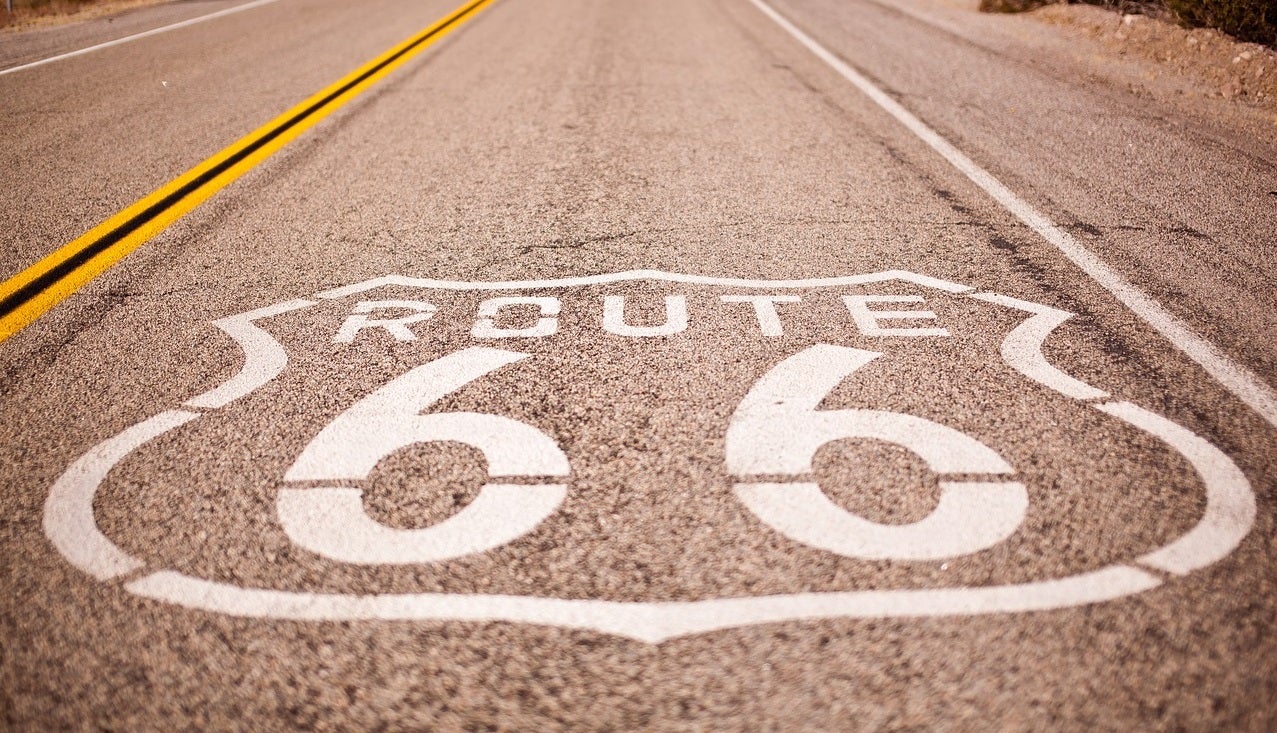
Arizona both is and isn’t what you expect it to be. Most of the pictures coming out of this land project the familiar arid and eroded elegance of the Grand Canyon and surrounding scrubland, and not the rolling greens of the extensive national forest around Flagstaff and east of Phoenix. But then again, part of what makes Arizona unique is the parched appeal of vast vistas under an open sky.
In the midst of one treeless low-foliage zone is an authentic stretch of the original, legendary Route 66, now just a ghost of its former self. One of the first great east-west American highways, Route 66 brought opportunities for faster travel and trade to a great swath of small-town rural America between Chicago and Los Angeles.
It also settled quickly and comfortably into the shifting sands of American lore as the “Mother Road” by John Steinbeck in The Grapes of Wrath and in a song by Bobby Troup.
However, in the years since its 1938 completion, much of the original road has been “improved” into nonexistence. Much of what had once thrived along the road has also passed into memory, some abandoned towns leaving only their ghostly remains behind.
That said, one particularly long stretch of the original path has kept the weeds at bay in northwestern Arizona, preserving with it a land frozen in time, complete with the architecture and feel of an early-20th-century American mining town.
Historic Route 66 from Seligman to Kingman is a gentle rolling strip of pavement that nevertheless loses almost 2,000 feet of elevation (heading west). You could of course do the trip against the grade in which case the buttes and hills won’t seem like much.
In addition, the best local resources (hotels, shops, etc.) are in Kingman, and you will probably want this at the end of your trip. Regardless of direction, the 90-mile ride is like a trip back to the 1920s and 1930s. You can almost imagine (and may in fact see!) cars from those decades making the sprint to one of the road’s bookend cities for a shopping spree or day trip.
Most locals do travel that distance since there is not much else in the way of food or accommodation along the way, something that you will need to take into account. If you have an extra day once you have reached Kingman, head further west toward Oatman.
The rough route is narrow and the terrain much more challenging than the previous ride, but you will enjoy the 10 or so miles to a genuine ghost town and abandoned gold mine.
If you are going to stretch your pedal into a relaxing weekend endeavor, plan on reserving ahead in the only real halfway option: the lodge at Peach Springs in the Hualapai Indian Reservation. (You may also ask in Peach Springs about permits for backcountry day hikes in the reservation lands.)
You might get lucky and find an old-style motel along the way or a small open convenience store, but don’t hedge your bets. Be prepared.
Okanogan Region, Washington
Washington State has a little of everything that its bigger southern neighbor has—beautiful coast, soaring mountains, abundant forest—without the curse of being bigger and to the south. Perhaps that’s why so many disgruntled Californians ponder moving north. Perhaps that’s why many Washingtonians want disgruntled Californians to stay right where they are.
The Okanogan region lies in the dry reaches east of the Cascade Mountains in northern Washington, midway between Seattle and Spokane. Bordered on the south by the mighty Columbia River and well ensconced in Okanogan National Forest, the terrain and vegetation are rich and varied.
So are the multitude of cycling route options relying initially on main drags and then plunging into the wild heart of the area on county and forest service roads following long river valleys or vista-rich ridgelines. From Lake Chelan, the Methow River, and the ridge in between to the North Cascades Scenic Highway, all in the west, to the Loup Loup Highway and distant Grand Coulee Dam in the east, there is plenty to do and see.
Try basing yourself in Chelan, Brewster, Okanogan, Twisp, or Winthrop. From any of these towns there are long road reaches on the main routes, some of which have tough passes, including Washington Pass on North Cascades Scenic Highway 20; Loup Loup Summit on Highway 20, just west of Okanogan; and Harts Pass, off of Route 20 from Mazama, which is one of the most scenic spots in the Methow Valley and the highest point to which you can drive in Washington State.
Better yet, ask at any of the information centers in these towns about the paved secondary roads of the Twisp and Winthrop districts. If you have brought a mountain bike with you just in case, don’t miss the Valley of the Trails.
There is much more than a weekend’s worth of riding here. The best thing to do is pick an area and give it the full benefit of your undivided attention. You can always come back for more. Read more about scenic drives in the area.
Highway One, California
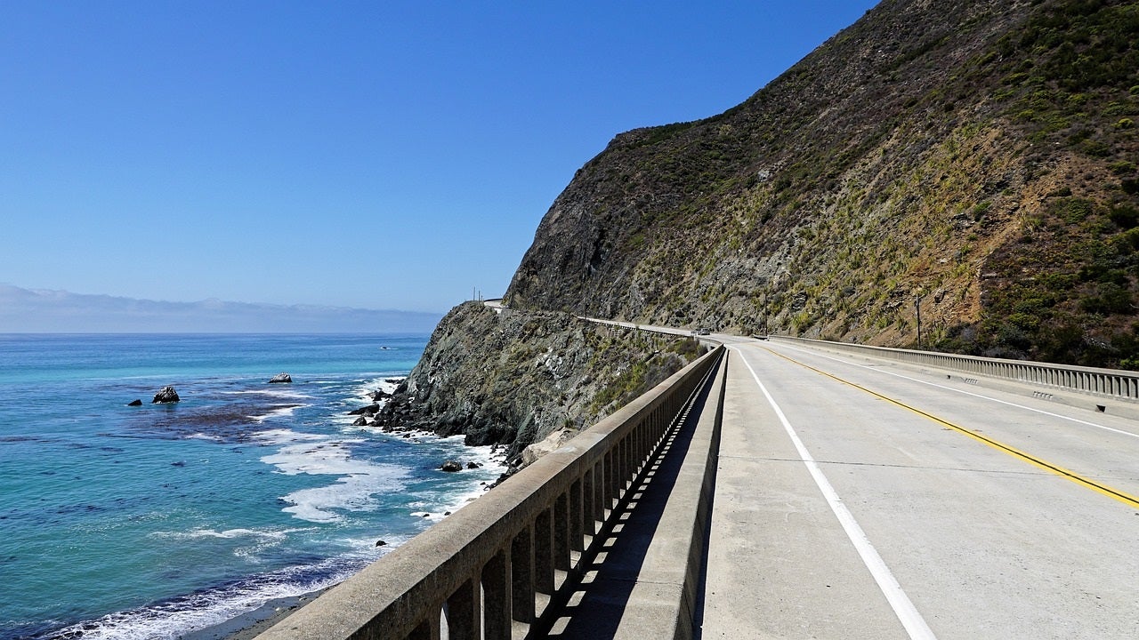
Sometimes non-Californians forget that California is a coastal state. Its political, economic, and agricultural stature, not to mention the renown of its rugged mountains and sere deserts, all conspire to distract us from the sprawling 1,200 miles of Pacific surf.
The seascape prism of sunset color that Easterners enjoy after a tough day of dabbling is the start of every day out west. Perhaps that is one of the reasons behind the United States’ contrasting coastal cultures.
I would describe California’s Highway One as a road that “clings to the wild coast of California: a thin, pliable line outlining rugged cliffs plunging to power-mad surf. Traveling Highway One is more than a scenic drive, it’s a pilgrimage; a reconnection to California’s history, environment, mythology—its spirit.” Who could say no to check out anything with so much promise?
There are a number of sections of Highway One that deserve whatever time allows, but basically the whole 250-mile stretch from San Francisco all the way to Morro Bay is a gem. Plus, the directions are exceedingly simple: Just stick to Highway One.
Of course, getting out of San Francisco can be a drag, but your conviction will be more than rewarded. From San Francisco to Santa Cruz is about 90 miles of stunning windswept coastal rolling. Be prepared in a couple of places for the space between you and the edge of a cliff to be guarded by nothing but the magic of adrenaline and alertness.
If Santa Cruz is as far south as you want to go, there are many area rides that can keep you busy (ask locally about the Swanton Loop ride).
Otherwise, it’s hilly but incomparable, windy and rocky road with plummeting views to ocean spray all the way from Santa Cruz through Monterey and into the heart of Big Sur. Pause for an evening at Julia Pfeiffer Burns State Park before a final press past Hearst San Simeon State Historic Monument (Hearst Castle), out of the hills and into the coastal grasslands of central California.
Tackle as much as time permits. One thing to keep in mind: Prevailing winds generally blow from north to south. So, bike south, then tackle a tough backtrack or have a friend ready to pick you up and take you home.
Be sure to take some gear like repair tool, tire pump, a lock for when you stop for a break and of course a pair of sunglasses to lessen eye fatigue.
And if you are looking for an entry-level road bike we have created two product review articles that can help you narrow your search with some excellent options: The 5 Best Road Bikes Under $500 and The 5 Best Road Bikes Under $1000. Have a great time riding.